

Tumbler Ridge, BC
The Town of Tumbler Ridge is located in the north east corner of British Columbia, on the eastern slopes of the Rocky Mountains, 100 km south of Chetwynd B.C. on Highway #29 or 97 km south of Dawson Creek. The town is located at the intersection of Highway 29 and 52 creating a loop that joins Chetwynd and Dawson Creek. Tumbler Ridge has a population of 2,399 (2021 statistics) with 1,093 occupied dwellings. In 2016 there were 1,987 people living here a decrease of -26.7% since 2011 when the population was 2,710.

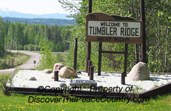
Tumbler Ridge Sign - more info
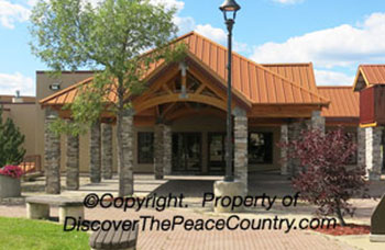
Community Centre - more info

Visitors Centre - more info
Campgrounds - more info


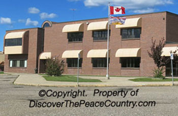
Tumbler Ridge RCMP - more info
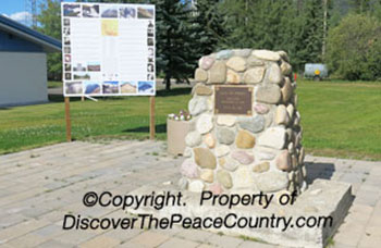
Cairn - Garden - more info

Tumbler Ridge Firehall - more info


HISTORY OF TUMBLER RIDGE, BC

There are riverboat tours of the Murray River and Kinuseo Falls available during the summer months.

Tumbler Ridge has a number of residential areas, each with a view of the mountains. Also view another residential area in the western part of Tumbler Ridge VIEW PHOTO
Special Events: The Major Events that take place each year in Tumbler Ridge is the Winter Carnival in the latter part of January, Multicultural Festival in April, and the Tumbler Ridge Triathlon Swim/Bike/Run at the end of May. Grizzly Valley Saddle Club Annual Poker Ride and Gymkhana takes place in June and the Canada Day Celebrations happens each July 1st. The Men's and Ladies' Open golf tournament is a regular summer event, Grizfest music festival takes place over the August long weekend. The Emperor's Challenge is the first Saturday after August long weekend. The Ridge Ramble cross-country run is planned for the fall, while the Halloween Haunted Experience takes place in October. November is for the Craft fairs event and in December Tumbler Ridge has is annual Holly Jolly Christmas Tree Light-up, The Christmas Light-up Contest and the Annual Toy Bingo.
The Tumbler Ridge Ridge Riders snowmobile club maintain over 300km of trails. During the winter months, many of the falls freeze and provide excellent ice for climbing. There are many cross-country ski trails that are groomed. The most popular trail is 10km long and starts at the golf course.
NOW POSTED Events of the Peace Country
Tumbler Ridge Schools - more info

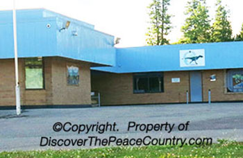
Health Centre - more info

The Legion - more info


Located 9 km north of Tumbler Ridge on Highway 52 is Quality Falls (Enlarge above photo). It is a good 20 minute hike one way. Quality Falls Sign VIEW PHOTO
Tumbler Ridge Global Park is made up of 43 geosites across 21 destination areas of geological and aesthetic interests that include many waterfalls, rock formations, lakes and canyons, mountain summits and caves. Tumbler Ridge is known as the "Waterfall Capital of the North". Just some of the sites to see are listed below:
BERGERON FALLS: The highest waterfall in Northern British Columbia at 100 meters. It is the closest falls to Tumbler Ridge at 16km northwest of town. One can get to this area along a 12 km trail.
KINUSEO FALLS: Located at Monkman Provincial Park
60 km suth of Tumbler Ridge BC. You can park right near the falls and have a close look from the viewing platform. VEW FEATURE PAGE
BABCOCK FALLS: Located 35km south of Tumbler Ridge, off Highway 52. Features a waterfall, meadows, swimming. About a 2km hike return.
BARBOUR FALLS:
Located about 63 km southeast of Tumbler RIdge. The 800 metre trail runs parallel to Barour Creek which is a tributary of the Murray River and can take about 1.5 hours to walk.
NESBITT'S KNEE FALLS: Located about 65 km southeast of Tumbler Ridge, BC. The trail is a round trip of 3km.
TRAILS IN THE AREA:
Map one VIEW PHOTO, Map two of Wolverine Nordic Trails VIEW PHOTO
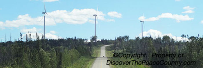
Wind Turbines are visible on the way into Tumbler RIdge along Highway 52, from Tomslake BC to Tumbler RIdge BC. It is the largest wind facility in British Columbia. Another Highway Photo with mountains VIEW PHOTO
In 1983, the Bullmoose mine, located 30 km west of town, employed as many as 300 people. The Quintette mine located 20km south of town, at the peak had as many as 1200 employees. Tumbler Ridge's population increased to close to 5000 people. When the world coal markets fell in the late 1990s, the Quintette mine closed in August 2000, causing many people to lose their jobs. This resulted in many businesses closing and the housing prices to fall and the town lost about half its population.
Bullmoose Mine also closed in April of 2003 after mining out the last of its coal seams. The Wolverine Deposit was then mined by Western Canadian Coal and opened in the fall of 2004 employing 250 people followed shortly after by Peace River Coal's Trend mine. Walter Energy bought Wolverine and Anglo American PLC bough Trend in 2013, but both mines closed in 2014 when coal prices dropped again. With no active coal mines running, the main Industries of Tumbler Ridge are Oil and Gas, and Tourism.
NEWSPAPER: The Tumbler RidgeLines VIEW PHOTO
(Tumbler Ridge NEWS)
Town of Tumbler RIdge BC WEBSITE
Tumbler RIdge Chamber of Commerce, with over 80 active members. WEBSITE
Tumbler RIdge Public Library WEBSITE
Dinosaur Discovery - more info

BC Rail Caboose - more info


Legal Notice - Terms and Conditions: All pictures, images, videos and information on DiscoverThePeaceCountry.com are protected by copyright which means it is unlawful to reproduce any picture, image or information in whole or part on any other media (that includes websites, facebook, twitter etc) without a licensing agreement. By using a copyright image without a licensing agreement, you agree to pay DiscoverThePeaceCountry.Ltd $10,000 per photo for the usage. © Copyright 2003-2024. Contact: PeaceCountryINFO@gmail.com